The Endless Atlas Project
Oct 2011
« The atlas is a book , a place where all the signs of the earth, from natural to cultural ones are conventionally represented: mountains, lakes , pyramids , oceans, cities, villages , stars , islands. In this totality of writing and description, we find the place where we live , where we want to go , the path to follow.»
Luigi Ghirri, Atlante, 1973
Inspired by this romantic and powerful image, we tried to build our Atlas.
The Endless Atlas Project is a photographic diary, a continuous and unconventional narrative made of images.
Like in Jon Rafman’s 9-Eyes Project, we use Google Street View photograpy as an affordable and detached point of view on the world. Street View photography has no artistic intensions, “ascribes no particular significance to any event or person.
Bereft of context, history or meaning, the only glue holding the Street View images together is geospatial contiguity.”
But Geospatial contiguity is also the base-concept of every geographic map.
So the challenge for us has become how to build a photographic archive like A map where all itineraries are possible.
To do this we applied to The Atlas the same structure of the web-blogging itself:
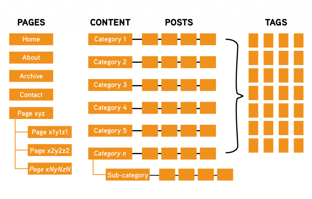
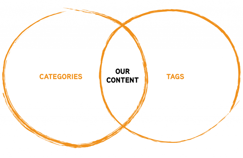
Categories are meant for broad grouping posts (read: contents).
Are general topics or the table of contents for websites. They also identify what a blog is really about. It is to assist readers finding the right type of content. And are hierarchical.
Tags are meant to describe specific details of posts. Like a website’s index words. An abacus.
They are the micro-data to micro-categorize the contents. Not hierarchical, they are also transversal to each content.
Considering each framed image (our content) a post, we can expand day by day the digital database and the abacus of tags, which is also a phenotypic index of remarkable places in our Atlas.
Inside this fragmented index, some images are also assigned to categories, which represent semantic routes, itineraries, autonomous projects into the project.
Within spatiality limits permitted by Google, The Endless Atlas Project tries to establish a cognitive photographic process, giving the visitor the opportunity to follow the suggested route but also the freedom to deviate from these.
Our Atlas is a method, it is for us the constant desire for discovery and the need to establish a love affair with photography and geography.
The continuous construction of an inner landscape and the attempt to represent it and to tell about it.
To discover, or rediscover, finally, places we live, where we want to go, paths we will follow.
